News
CARIS and the University of Southampton
Thanks to CARIS, more students of Ocean and Earth Sciences at the University of Southampton will be getting an insight into the latest technologies used for mapping the seabed.
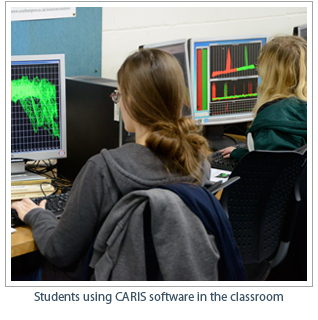 Up to 100 undergraduate and masters students of geophysics, geology, oceanography, and marine biology will now have the opportunity to use CARIS' various applications to understand the topography of seas and oceans around the world. This helps develop analytical skills that will be invaluable in their future careers. CARIS has granted 100 software licenses to the university, thereby enabling large groups of students to work collectively.
Third year BSc Geophysics student Matt Hollinrake is using CARIS in his dissertation. "I am researching shipwrecks around LundyIsland in the Bristol Channel and find the software invaluable to see the area in 3D, details including the track of the ships. I’m sure knowing how to use CARIS will help me when I start looking for a job as a marine surveyor after graduation."
Dr. Justin Dix, Associate Professor in Marine Geophysicsexplains: "There are many job opportunities around the world for graduates skilled in this technology, including offshore wind power projects, oil and gas rig decommissioning and applications in navigation, maritime conservation and the military. Our ten year collaboration with CARIS now enables even more of our students to learn this industry-standard system and get a head start in the job market after graduation."
Join our Mailing List
Subscribe to email announcementsOur Latest Tweets
Tweets by Teledyne CARIS Follow us on TwitterConnect With Us
